Research and Publications

View article.
Here, we examine how the ventenata invasion alters simulated fire across forest-mosaic landscapes of the 7 million ha Blue Mountains Ecoregion using the large fire simulator (FSim) with custom fuel landscapes: present-day invaded versus historic uninvaded. Invasion increased simulated mean fire size, burn probability, and flame lengths throughout the ecoregion, and the strength of these impacts varied by location and scale. Changes at the ecoregion scale were relatively modest given that fine fuels increased in only 2.8% of the ecoregion where ventenata invaded historically fuel-limited vegetation types. However, strong localized changes were simulated
within invaded patches (primarily dwarf-shrublands) and where invasion facilitated fire spread into nearby forests.

View article.
This review summarises a growing body of evidence indicating that greater use of in situ, remotely sensed, and modelled soil moisture information in fire danger rating systems could lead to better estimates of dynamic live and dead herbaceous fuel loads, more accurate live and dead fuel moisture predictions, earlier warning of wildfire danger, and better forecasts of wildfire occurrence and size. Potential uses of soil moisture information in existing wildfire danger rating systems include (1) as a supplement or replacement for drought indices, (2) for live and (3) dead fuel moisture modelling, (4) for estimating herbaceous fuel curing, and (5) for estimating fuel loads. We identify key remaining research questions and note the logistical challenge of convincing wildfire professionals of the importance of soil moisture compared with more familiar wildfire danger metrics. While obstacles remain, the path forward is clear. Soil moisture information can and should be used to improve fire danger rating systems and contribute to more effective fire management for the protection of communities and ecosystems worldwide.
View article.
Interactions among species can strongly affect how plant communities reassemble after disturbances, and variability among native and invasive species across environmental gradients must be known in order to manage plant-community recovery. The stress-gradient hypothesis (SGH) predicts species interactions will be more positive in abiotically stressful conditions and conversely, more negative in benign conditions, and the resistance-resilience concept (RRC) may predict where and when invasions will complicate ecosystem recovery. We evaluated how abiotic stress and biotic interactions determine native bunchgrass abundances across environmental gradients using additive models of cover data from over 500 plots re-measured annually for 5 years as they recovered naturally (untreated) after a megafire (>100,000 ha) in sagebrush steppe threated by the invasive-grass and fire cycle.
View story map.
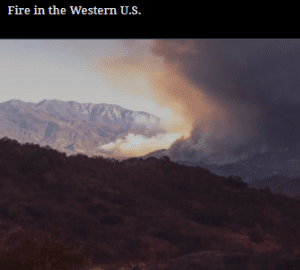
But over the past few decades, wildfires have worsened by almost every metric. It’s impossible to ignore this new consequence of environmental change. Fires are getting larger, more severe, more destructive and dangerous, and eliminating entire patches of forests, grasslands, and shrublands.
The combination of changing climate, extreme weather, land use, aggressive fire suppression policies, and wildland urban interface expansion have contributed to altered fire behavior regimes. And all of these past and current factors are converging in a big way in the western U.S. Today’s megafires pose an increasing threat to human health, infrastructure, natural resources, and ecosystem resilience.
View article.
Qualifying studies focused primarily but not exclusively on forested landscapes of the western USA and ranged in size from 200 to 3,400,000 ha. Most studies showed that scenarios with fuel reduction treatments had lower levels of wildfire compared to untreated scenarios. Damaging wildfire types decreased while beneficial wildfire increased as a result of treatments in most cases where these were differentiated. Wildfire outcomes were influenced by five dimensions of treatment design (extent, placement, size, prescription, and timing) and other factors beyond the treatments (weather, climate, fire/fuel attributes, and other management inputs). Studies testing factorial combinations showed that the relative importance of these factors varied across landscapes and contexts.
View report.
This report examines the needs for native plant restoration and other activities, provides recommendations for improving the reliability, predictability, and performance of the native seed supply, and presents an ambitious agenda for action. An Assessment of Native Seed Needs and the Capacity for Their Supply considers the various challenges facing our natural landscapes and calls for a coordinated public-private effort to scale-up and secure a cost-effective national native seed supply.
View article.
Safety zones (SZs) are critical tools that can be used by wildland firefighters to avoid injury or fatality when engaging a fire. Effective SZs provide safe separation distance (SSD) from surrounding flames, ensuring that a fire’s heat cannot cause burn injury to firefighters within the SZ. Evaluating SSD on the ground can be challenging, and underestimating SSD can be fatal. We introduce a new online tool for mapping SSD based on vegetation height, terrain slope, wind speed, and burning condition: the Safe Separation Distance Evaluator (SSDE). It allows users to draw a potential SZ polygon and estimate SSD and the extent to which that SZ polygon may be suitable, given the local landscape, weather, and fire conditions. We begin by describing the algorithm that underlies SSDE. Given the importance of vegetation height for assessing SSD, we then describe an analysis that compares LANDFIRE Existing Vegetation Height and a recent Global Ecosystem Dynamics Investigation (GEDI) and Landsat 8 Operational Land Imager (OLI) satellite image-driven forest height dataset to vegetation heights derived from airborne lidar data in three areas of the Western US. This analysis revealed that both LANDFIRE and GEDI/Landsat tended to underestimate vegetation heights, which translates into an underestimation of SSD. To rectify this underestimation, we performed a bias-correction procedure that adjusted vegetation heights to more closely resemble those of the lidar data. SSDE is a tool that can provide valuable safety information to wildland fire personnel who are charged with the critical responsibility of protecting the public and landscapes from increasingly intense and frequent fires in a changing climate. However, as it is based on data that possess inherent uncertainty, it is essential that all SZ polygons evaluated using SSDE are validated on the ground prior to use.
View article.
Wildfire is a natural phenomenon with substantial economic consequences, and its management is complex, dynamic, and rife with incentive problems. This article reviews the contribution of economics to our understanding of wildfire and highlights remaining knowledge gaps. We first summarize economic impacts to illustrate scale and trends. We then focus on wildfire management in three phases: mitigation before fires occur, response during fires, and response after fires. The literature highlights economic interdependencies and spillover effects across fire-prone landscapes as the source of economic inefficiencies and motivation for public institutional response. The literature illustrates the complexity of this problem with its myriad threads, including the trade-offs of living in fire-prone environments, the prospects for using controlled fire and mechanical fuel removal for reducing wildfire severity, the decision-making environment that firefighters face, and the economic consequences of wildfire smoke on health. Economics provides valuable insights, but fundamental questions remain unanswered.
View article.
We examined the financial efficiency and effectiveness of landscape versus community protection fuel treatments to reduce structure exposure and loss to wildfire on a large fire-prone area of central Idaho. The study area contained 63,707 structures distributed in 20 rural communities and resorts, encompassing 13,804 km2. We used simulation modeling to estimate expected structure loss based on burn probability and characteristics of the home ignition zone. We then designed three fuel management strategies that targeted treatments to: 1) the surrounding areas predicted to be the source of exposure to communities from large fires, 2) the home ignition zone, and 3) a combination of the landscape and home ignition zone. We evaluated each treatment scenario in terms of exposure and expected structure loss compared to a no-treatment scenario. The potential revenue from wood products was estimated for each scenario to assess the cost-efficiency. We found that the combined landscape and home ignition zone treatment scenario which treated 5.7% of the study area resulted in the highest overall reduction in predicted exposure (47.5%, 100 structures yr- 1) and predicted loss (69.1%, 57 structures yr- 1). Home ignition zone treatments provided the best predicted economic and per area treated performance where exposure and loss were reduced by one structure by treating 89 and 111 ha per year, respectively, with an annual cost of $33,645 and $73,672. Revenue from thinning was the highest for landscape fuel treatments and covered 16% of the required investment. This work highlighted economic and risk tradeoffs associated with alternative fuel treatment strategies to protect developed areas from large wildland fires.
We systematically selected and reviewed 20 thinning studies to analyze key variables affecting machine productivity and harvesting costs. The average cost of forest thinning was lowest for a mechanized whole-tree thinning operation at $21.34/ton or $2,075/ha. Feller-bunchers and skidders showed the highest productivity in felling and extraction machines, respectively.