Research and Publications

View factsheet.
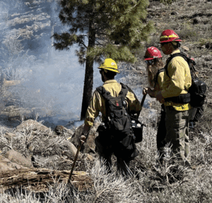
Fire is an ecosystem process managed in the contemporary western U.S. at great expense, but with mixed results— yet it is one that can be re-worked to positive effect by melding ancient burning practices with contemporary scientific findings.
The “natural infrastructure” elements of stone and wood are components of ecosystem processes whose contemporary application, when guided by ancient practices and recent research, can mitigate some of the negative effects of contemporary fire regimes.
The following fact sheet is a summary of our 2025 working paper which considers how scientific research and creative on-the-ground applications that merge ancient and contemporary approaches and techniques can improve both pre-event resilience, and post-event recovery outcomes.

View report.
Geospatial products of land use and land cover are broadly used in many applications. For example, the annual national greenhouse gas inventory uses the National Land Cover Database, the Coastal Change Analysis Program, Landscape Fire and Resource Management Planning Tools, the Forest Inventory and Analysis, and the National Resources Inventory to represent the land use and management base of the United States and attribute sources and sinks of greenhouse gas emissions. Federally produced land use and land cover datasets for the United States, including those from the Multi-Resolution Land Characteristics Consortium, set the foundation for developing and informing applications such as land change, conservation, greenhouse gas monitoring, urban planning, agricultural production, ecosystem functions, and water quantity and use. No single land use and land cover product is optimal for all land use and land cover applications. Approaches for defining and mapping land use and land cover classes differ across Federal map products, reflecting the tailoring of product specifications to match specific agency needs. These differing approaches present a challenge when attempting to integrate and harmonize multiple land use and land cover products into single analysis or application frameworks. Nuanced understanding of how these products are designed and produced may not be immediately evident to users; however, the availability of a diverse suite of products also represents an opportunity, providing multiple approaches for observing landscape change. In response to the National Strategy to Advance an Integrated U.S. Greenhouse Gas Measurement, Monitoring, and Information System, this Multi-Resolution Land Characteristics Consortium-led interagency report presents (1) the current status of U.S. Federal land use and land cover products (as of May 2024), (2) existing synergies and integration among these federally produced land use and land cover products, (3) inherent challenges of creating a single consistent
framework, and (4) strategies for collectively tackling these challenges to improve coordination and collaboration among data producers and facilitate the adoption of land use and land cover products for greenhouse gas monitoring and a variety of other applications.
View factsheet.
In mountain big sagebrush associations, simulations of prescribed burn fuel treatments indicated that treatments were economically efficient in ecosystems dominated by sagebrush or in the early to mid-phases of pinyon-juniper expansion when compared to expected suppression costs. For low sagebrush, mechanical fuel treatments were not economically efficient, mainly due to higher associated costs. For black sagebrush, mechanical fuel treatments led to increased suppression costs in three of six potential treatment settings largely due to increases in surface fuels and fire behavior.
While wildfire suppression cost savings were the primary benefit, economic benefits included enhanced wildlife habitat, water availability, livestock grazing, and recreational opportunities. This research suggests that if land managers consider treatment costs along with specific sagebrush associations and their resilience and resistance levels, they can plan more effective and efficient fuel treatments.
View brief.
• Tree invasion of sagebrush habitat in southwest Montana has caused a 30% decline in the population of Brewer’s sparrows since 1954.
• If nothing is done to prevent tree encroachment, Brewer’s sparrows will decline by 60% in the next 30 years.
• Defending core sagebrush habitat through conifer removal can maintain populations of Brewer’s sparrows into the future

View article.
We found that aspen slows fire progression: as aspen cover on the landscape increased, daily area burned and linear spread rate decreased. Where aspen cover was <10%, daily fire growth averaged 1112 ha/day and maximum linear spread was 2.1 km/day; where aspen exceeded 25%, these values dropped to 368 ha/day and 1.3 km/day. Aspen also serves as a barrier to fire spread, demonstrated through a higher proportion of aspen cover at fire perimeters than in burn interiors. Finally, though favorable fire weather conditions increased fire growth rates, differences between aspens and conifers persisted. Our results affirm that aspen stands can act as a firebreak, with clear applications for vegetation management. For example, interventions that shift conifer to aspen cover could lessen the risk of fire for nearby values at risk (e.g., communities, infrastructure) but still support forest ecosystem function. Further, wildfire-driven conversion from conifer to aspen forest types in some landscapes may produce a negative feedback that could dampen expected increases in fire activity under a warmer and drier climate.
View article.
Our study highlights that fuel characteristics and broadcast burning disproportionally impacted burn severity, with Rx being the most effective and economical treatment. By creating a reproducible framework to explain burn severity, at both global and local scales, we gained nuanced insights about the drivers of burn severity that could inform and enhance fire and fuel management practices across multi-ownership landscapes.
View brief.
In this analysis, we tested the influence of the suppression model on FSim simulations by running simulations in four regions with a range of nine suppression factors, and one simulation run without the suppression model. To test whether the suppression model resulted in fire shapes that were more similar to historical observed fires, we calculated six metrics of shape complexity from the simulated wildfire perimeters. We then compared these shape metrics to shape metrics of the historical wildfire perimeters in each region. This established that the suppression model contributed to closer agreement in shape metrics between simulated and historical fire perimeters, and that the suppression factor where this agreement was maximized differed between simulation areas.
View synthesis.
This report synthesizes current (2024) science-based knowledge related to the impacts of climate change on big sagebrush vegetation in Western North America. This effort was conducted through the U.S. Geological Survey working with the Bureau of Land Management as part of multiple science syntheses to aid management agencies developing environmental impacts assessments in response to human-related or caused events. This report reviews the potential impacts climate change may have on sagebrush vegetation and related management decisions. The body of the synthesis introduces the diverse impacts of climate change across the region by first focusing directly on what climate change may entail in terms of altered temperature and precipitation patterns. The report then discusses how these changes could likely affect individual plant species based on experimental results and scale the impacts to species distributions and community composition. The synthesis section ends by surveying efforts to model potential future changes in habitat. The report goes on to link the synthesis conclusions to individual land uses or land management decisions, such as forage resources, restoration or fuel treatment. Finally, the report provides a section that discusses the pros and cons of available datasets that model the potential future of vegetation in the sagebrush region.
View field brief.
This brief shares insights from a June 4, 2024, prescribed fire field day hosted by the US Forest Service (USFS) and Great Basin Fire Science Exchange (GBFSE). The field day highlighted burn plan development in the Wildland Urban Interface (WUI) of Whites Creek on the Humboldt Toiyabe National Forest. It also serves as an example of the types of relationship-building and communication opportunities and products the GBFSE makes possible through regional fire management partnerships.
View article.
To better understand the social acceptability of core features of ISM in the United States, we conducted an online experiment with vignettes describing hypothetical but realistic ISM scenarios, varying targeted taxon (insect or plant), control method (mechanical, chemical and biological), risk severity (low and high) and type of non-target risk (to humans or native species). Not surprisingly, management with low risk was most acceptable, particularly for mechanical control. In high-risk scenarios, only mechanical control was acceptable, but only by a slim majority of respondents. Overall, chemical and biological controls showed low levels of acceptability. Surprisingly, there was no significant difference in how respondents ranked risks to people and risks to native species. Beyond differences in acceptability between management factors, we also find that the acceptability of management and attitudes towards risk were associated with respondents’ demographic characteristics. Overall, our findings indicate that widespread acceptability of ISM should not be assumed. While management activities representing low-risk scenarios find some support in the public, our results highlight a disconnect between the effectiveness of common management methods and their social acceptability. Our findings highlight the need for evidence-guided ISM, which includes evidence of harmful impacts of introduced species, as well as risks and benefits of management activities, as one potential way to increase the social acceptability of non-native species management.