Article / Book
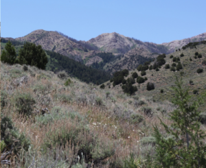
This special issue of Rangeland Ecology and Management is dedicated to applying the Sagebrush Conservation Design (SCD) to improve conservation outcomes across the sagebrush biome in the face of pervasive ecosystem threats.
Articles included:
State of the sagebrush: Implementing the Sagebrush Conservation Design to save a biome
Closing the conservation gap: Spatial targeting and coordination are needed for to keep pace with sagebrush losses
Climate change amplifies declines in sagebrush ecological integrity
Well-connected core areas retain ecological integrity of sagebrush ecosystems amidst overall declines 2001–2021
Spatial prioritization of conifer management to defend and grow sagebrush cores
A strategic and science-based framework for management of invasive annual grasses in the sagebrush biome
Modeling cropland conversion risk to scale-up averted loss of core sagebrush rangelands
Characterizing wildfire risk for the Sagebrush Conservation Design
An assessment of conservation opportunities within sagebrush ecosystems of US National Parks and Wildlife Refuges
Tool to promote stepping down the Sagebrush Conservation Design to local conservation planning
Exploring the sage grouse initiative’s role in defending and growing sagebrush core areas
Satellite remote sensing to assess shrubland vegetation responses to large-scale juniper removal in the northern Great Basin
Cooperative conservation actions improve sage-grouse population performance within the bi-state distinct population segment
Evaluating the Sagebrush Conservation Design Strategy through the performance of a sagebrush indicator species
How a Sagebrush Conservation Strategy benefits rangeland birds
Carbon Security Index: Novel approach to assessing how secure carbon is in sagebrush ecosystems within the Great Basin
Using technical transfer to bridge science production and management action
Assessing conservation readiness: The where, who, and how of strategic conservation in the sagebrush biome
Where do we go from here with sagebrush conservation: A long-term perspective?
There is no hope without change: A perspective on how we conserve the sagebrush biome
View article.
Abundances of dominant invaders, cheatgrass and Russian thistle, were measured along treated and neighboring untreated edges in 40 paired plots along ∼61 km of 60-m wide fuel breaks. Fuel breaks were constructed using a variety of shrub-cutting and herbicide applications 1–4 yr before measurement. Generalized linear mixed effect models revealed that fractional cover significantly increased in treated compared with untreated areas by 0.02–0.12 for cheatgrass and 0–0.06 for Russian thistle within 9 m of treatment boundaries (on a scale of 0-1). We neither detected increased invasion in adjacent and untreated areas nor gradients of increasing invasion with proximity to treatment boundaries. Although these findings reveal invasions that were otherwise undetected across the entire 60 m width of fuel breaks, invasion levels did not surpass nominal management thresholds for fire behavior or risk of conversion to annual grasslands.

View article.
Climate change is altering fire regimes and post-fire conditions, contributing to relatively rapid transformation of landscapes across the western US. Studies are increasingly documenting post-fire vegetation transitions, particularly from forest to non-forest conditions or from sagebrush to invasive annual grasses. The prevalence of climate-driven, post-fire vegetation transitions is likely to increase in the future with major impacts on social–ecological systems. However, research and management communities have only recently focused attention on this emerging climate risk, and many knowledge gaps remain. We identify three key needs for advancing the management of post-fire vegetation transitions, including centering Indigenous communities in collaborative management of fire-prone ecosystems, developing decision-relevant science to inform pre-and post-fire management, and supporting adaptive management through improved monitoring and information-sharing across geographic and organizational boundaries. We highlight promising examples that are helping to transform the perception and management of post-fire vegetation transitions.
View article.
Increasing impacts from wildfires are reshaping fire policies worldwide, with expanded investments in a wide range of fuel reduction strategies. In many fire prone regions, especially in the Mediterranean basin, fuel management programs have relied on fuel break networks for decades to facilitate fire suppression and reduce area burned and damage. By contrast, on the fire prone federal forests in the western United States, fuel management is guided primarily by landscape restoration goals, including improving fire resiliency such that wildfires can be managed for ecological benefit, and suppression is used more as a tool to shape burn patterns and less to extinguish fires. New policies in both fire systems are now calling for hybrid approaches that rely on both types of investments and efficient allocation of alternative spatial treatment patterns: linear networks versus patches across the landscape. However, studies that combine these strategies and examine alternative co-prioritization outcomes and potential synergies are largely non-existent. Here, we analyzed scenarios for implementing both types of treatments in concert while varying the prioritization metrics for one type or the other on a western United States national forest.
View article.
The scale of wildfire impacts to the built environment is growing and will likely continue under rising average global temperatures. We investigate whether and at what destruction threshold wildfires have influenced human mobility patterns by examining the migration effects of the most destructive wildfires in the contiguous U.S. between 1999 and 2020. We find that only the most extreme wildfires (258+ structures destroyed) influenced migration patterns. In contrast, the majority of wildfires examined were less destructive and did not cause significant changes to out- or in-migration. These findings suggest that, for the past two decades, the influence of wildfire on population mobility was rare and operated primarily through destruction of the built environment.
View article.
Accurate drought assessments are critical for mitigating the deleterious impacts of water scarcity on communities across the world. In many regions, deficits in soil moisture represent a key driver of drought conditions. However, relationships between soil moisture and widely used drought indicators have not been thoroughly evaluated. In addition, there has not been an in‐depth assessment of the accuracy of operational soil moisture models used for drought monitoring. Here, we used 2,405 observed time series of soil moisture from 637 long‐term monitoring stations across the conterminous United States to test the ability of meteorological drought indices and soil moisture models to accurately characterize soil moisture drought. The optimal timescales for meteorological drought indices varied substantially by depth, but were ~30 days for depth averaged conditions; progressively longer timescales (∼10-80 days) represent progressively deeper soil moisture (2-36 in.). However, soil moisture models (including Short‐term Prediction Research and Transition Center, Soil Moisture Active Passive L4, and Topofire) significantly outperformed the meteorological drought indices for predicting standardized soil moisture anomalies and drought conditions. Additionally, soil moisture models represent near instantaneous conditions, implicitly aggregating antecedent data thereby eliminating the need for timescales, providing a more effective and convenient method for soil moisture drought monitoring. We conclude that soil moisture models provide a straightforward and favorable alternative to meteorological drought indices that better characterize soil moisture drought.
View article.
Severe fire limited N uptake by plants. Dry conditions after fire limited both plant and microbial N uptake. Implications. When fire is severe or when soils are relatively dry after fire, recovering plants and microbes are less likely to take up post-fire N and therefore, N in these sites is more susceptible to export.
View article.
We developed a framework for identifying which biotic traits would provide the best initial indication of longer-term target restoration goals and applied the framework to restoration drill-seedings of deep-rooted perennial bunchgrasses (DRPBGs) used to rehabilitate and restore semiarid rangelands threatened by exotic annual grasses (EAGs, e.g. cheatgrass) and the recurrent wildfire that EAGs cause. Initial traits measured included cover, basal diameter, height, and density (#plants/area) of DRPBGs and cover of EAGs and Sandberg bluegrass (Poa secunda, POSE, a disturbance-adapted perennial). The longer-term target objective was ≥25 % DRPBG cover and ≤13 % EAG cover by the 5th year following drill-seedings. Measurements were made on 112 plots spanning 113,000 ha in sagebrush steppe on the Soda wildfire scar, in the Northern Great Basin, USA. Traits of DRPBGs tended to be uncorrelated with one another, thus each was informative in describing vegetation condition. Where DRPBG cover was initially >17 %, it tended to become >25 % by the 5th-year post-seeding. In plots that overcame an initial risk of not meeting the target objective (i.e. <17 % initial DRPBG cover), DRPBG tended be large DRPBGs (>22.8 cm height) and plots also had >7 % cover of POSE. Additional “sets” of initial vegetation traits were also predictive of longer-term restoration success or failure. Restoration drill-seeding of DRPBGs is a key but varied-outcome tool for breaking the exotic grass-fire cycle, and, contrary to a conventional tendency to rely on a limited number of mean traits such as % cover, a suite of biotic traits appears necessary to monitor to reliably know if trials are likely to yield success.
View article.
Climate change shifts ecosystems, altering their compositions and instigating transitions, making climate change the predominant driver of ecosystem instability. Land management agencies experience these climatic effects on ecosystems they administer yet lack applied information to inform mitigation. We address this gap, explaining ecosystem shifts by building relationships between the historical locations of 22 ecosystems (c. 2000) and abiotic data (1970–2000; bioclimate, terrain) within the southwestern United States using ‘ensemble’ machine learning models.
View article.
We used data from a 5-year grazing experiment in the Northern Great Plains of the US. We tested whether grazing management treatments affect SIC, and whether grazing-induced SOC accrual was potentially offset by SIC loss. The experiment had a randomised complete block design and pretreatment data. Response variables were SOC and SIC stocks (0–60 cm depth). Moderate summer grazing (control) is regionally common and treatments that may alter soil stocks included: no grazing, severe summer grazing, moderate autumn grazing, and severe autumn grazing. We also tested for a negative relationship between SOC and SIC across all soil cores (n = 244). Severe grazing (summer and autumn) increased SOC by 0.83 and 0.88 kg × m−2 relative to moderate summer grazing, respectively. However, no treatments affected SIC. Conversely, we found an overall weak but significant (r2 = 0.04, P = 0.002), near one-to-one negative relationship between SIC and SOC stocks of soil cores. Our findings suggest severe grazing can increase SOC without affecting SIC, at least over the short term (5 years). This finding mirrors results from an observational study elsewhere in the Northern Great Plains that also failed to detect grazing effects on SIC. Long-term grazing experiments (>5 years) with pretreatment data may be required to detect grazing effects on SIC.