Fact Sheet / Brief

View factsheet.
Fire is an ecosystem process managed in the contemporary western U.S. at great expense, but with mixed results— yet it is one that can be re-worked to positive effect by melding ancient burning practices with contemporary scientific findings.
The “natural infrastructure” elements of stone and wood are components of ecosystem processes whose contemporary application, when guided by ancient practices and recent research, can mitigate some of the negative effects of contemporary fire regimes.
The following fact sheet is a summary of our 2025 working paper which considers how scientific research and creative on-the-ground applications that merge ancient and contemporary approaches and techniques can improve both pre-event resilience, and post-event recovery outcomes.
View factsheet.
In mountain big sagebrush associations, simulations of prescribed burn fuel treatments indicated that treatments were economically efficient in ecosystems dominated by sagebrush or in the early to mid-phases of pinyon-juniper expansion when compared to expected suppression costs. For low sagebrush, mechanical fuel treatments were not economically efficient, mainly due to higher associated costs. For black sagebrush, mechanical fuel treatments led to increased suppression costs in three of six potential treatment settings largely due to increases in surface fuels and fire behavior.
While wildfire suppression cost savings were the primary benefit, economic benefits included enhanced wildlife habitat, water availability, livestock grazing, and recreational opportunities. This research suggests that if land managers consider treatment costs along with specific sagebrush associations and their resilience and resistance levels, they can plan more effective and efficient fuel treatments.
View brief.
• Tree invasion of sagebrush habitat in southwest Montana has caused a 30% decline in the population of Brewer’s sparrows since 1954.
• If nothing is done to prevent tree encroachment, Brewer’s sparrows will decline by 60% in the next 30 years.
• Defending core sagebrush habitat through conifer removal can maintain populations of Brewer’s sparrows into the future
View brief.
In this analysis, we tested the influence of the suppression model on FSim simulations by running simulations in four regions with a range of nine suppression factors, and one simulation run without the suppression model. To test whether the suppression model resulted in fire shapes that were more similar to historical observed fires, we calculated six metrics of shape complexity from the simulated wildfire perimeters. We then compared these shape metrics to shape metrics of the historical wildfire perimeters in each region. This established that the suppression model contributed to closer agreement in shape metrics between simulated and historical fire perimeters, and that the suppression factor where this agreement was maximized differed between simulation areas.
View field brief.
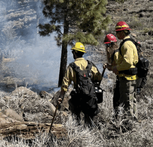
This brief shares insights from a June 4, 2024, prescribed fire field day hosted by the US Forest Service (USFS) and Great Basin Fire Science Exchange (GBFSE). The field day highlighted burn plan development in the Wildland Urban Interface (WUI) of Whites Creek on the Humboldt Toiyabe National Forest. It also serves as an example of the types of relationship-building and communication opportunities and products the GBFSE makes possible through regional fire management partnerships.
View factsheet.
This paper will explore the relationship of the climate-nature nexus to wildfire in four sections:
- Summarize the state of the science on how climate and ecosystem changes are exacerbating fire risk.
- Showcase opportunities where ecosystem services may be used to reduce fire hazard and support fire defences.
- Identify barriers to implementing such risk reduction measures.
- Propose policy, financial, and research tools where insurance sector risk expertise can support nature-positive wildfire mitigation at the landscape scale. This helps mitigate risk to support insurability
for the long haul.
View brief.
The dimensions of specialization, personal experience, and transmission of Indigenous Knowledges and Sciences (IKS) are diverse and complex. Researchers and professionals need to recognize this diversity and understand that the information gathered by Indigenous Peoples is collected and communicated in different ways. Immense variation is present among Indigenous cultural roles, languages, and oral histories, as well as in methods of obtaining information. In order for IKS to maintain its accuracy, reliability, and relevance, users must dedicate time and resources to its interpretation and contextualization. Western thought and reasoning does not inherently align with the complexities of Indigenous knowledge transmission; thus, working with tribal experts to gain well-rounded understanding and avoid bias is recommended.
View brief.
Two studies found that planting site climate, post-planting weather, planting season, tree seed lot sources, and tree species had particularly meaningful impacts on planted tree seedling performance after fire. Although the survival monitoring data used in both studies were limited to tree seedling survival after the first growing season, survival rates for this vulnerable period were linked to longer-term survival trends.
View factsheet.
This brief summarizes a recent study that assessed factors driving perceived defensibility through the lens of wildland firefighters to learn more about how they evaluate the risks associated with different structures. It provides insight into structure defensibility in action, and the factors that firefighters may consider when they engage a fire near structures.
View factsheet.
When we talk about wildfire fuel, we don’t mean gasoline or diesel. The term fuel refers to both dead and living vegetation that can burn, as well as homes and other structures that can ignite. This is particularly important in areas where urban development meets the natural environment, known as the wildland urban interface (WUI). Wildfires are becoming increasingly destructive across many ecosystems, including forests, woodlands, and rangelands. Climate change, human-caused ignitions, the encroachment of homes into the natural environment and the volume, density and health of fuel on the landscape all contribute to this escalating problem. In this fact sheet, we will explore some different “tools in the toolbox” for managing fuel in Nevada.