Story Map

View story map.
This story map accompanies the publication (Strand et al. 2025) and describes how anthropogenic and naturally occurring events have shaped the region. We looked at how and where fires occurred in the past and compared that to more contemporary fire records. These findings provide guidance for natural resource professionals looking for the best available science to inform their management.
View story map.
Across western North America, drought (measured by vapor pressure deficit [VPD], or how dry the atmosphere is) has contributed to a considerable increase in wildfire activity and extent in recent decades . Fire seasons are not only getting drier, they are also getting longer.

View story map.
More than half of wildfires burn in rangelands.
View storymap.
Public and private landowners have come together to lay out a path for recovery. Major partners in the region are uniting behind a groundbreaking cross-jurisdictional approach to restore resilient forests in Oregon’s Klamath and Lake counties. The resulting strategy has become a national blueprint for post-wildfire recovery.
View story map.
Potential Operational Delineations (PODs) a strategic collaborative spatial wildfire planning framework and decision support tool for wildfire response and mitigation. Background, primer, and use of sections included.
View story map.
The wildland-urban interface (WUI) is the area where structures and other human development intermingle with wildland vegetation or where housing is in the vicinity of large areas of wildland vegetation. This StoryMap provides data on two trends from 1990 to 2020: the expansion of WUI area and the growth in housing in WUI areas.
View story map.
The wildland-urban interface (WUI) is the area where structures and other human development intermingle with wildland vegetation or where housing is in the vicinity of large areas of wildland vegetation. This story map provides data on two trends from 1990 to 2020: the expansion of WUI area and the growth in housing in WUI areas.
View story map.
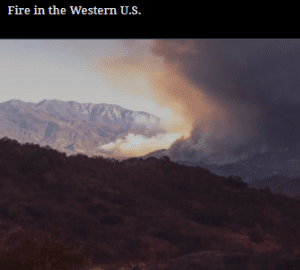
But over the past few decades, wildfires have worsened by almost every metric. It’s impossible to ignore this new consequence of environmental change. Fires are getting larger, more severe, more destructive and dangerous, and eliminating entire patches of forests, grasslands, and shrublands.
The combination of changing climate, extreme weather, land use, aggressive fire suppression policies, and wildland urban interface expansion have contributed to altered fire behavior regimes. And all of these past and current factors are converging in a big way in the western U.S. Today’s megafires pose an increasing threat to human health, infrastructure, natural resources, and ecosystem resilience.
View storymap.
This StoryMap is an overview of some of the work undertaken by FireEarth scientists, serving as an introduction to the project. FireEarth is not a standalone endeavor, as the work draws on past and concurrent efforts in the field of wildfire science, which are referenced when applicable.
The StoryMap is organized around 13 main sections: 1) About the FireEarth StoryMap, 2) An Introduction to Wildfire, 3) FireEarth’s Goal, 4) Cascading Consequences of Fire, 5) Erosion and Runoff, 6) Cascading Consequence: Fire Intensity Impacts, 7) Regional Hydro-Ecologic Simulation System (RHESSys), 8) Smoke and Air Pollution, 9) Reducing Our Vulnerabilities to Wildfire, 10) Community Adaptation to Fire, 11) Biomimicry: Copying Nature to Coexist with Fire, 12) Conclusion, and 13) All FireEarth-Supported Papers.

View story map.
On a dry winter morning between Christmas and New Year’s Eve 2021, the communities in Boulder County braced for the wind. The area lies at the base of the Front Range, made up of flat-topped mesas and open grasslands where creek bottoms are lined with cottonwood trees. On the outskirts of the communities are scattered homes and ranchettes. Farther east are established neighborhoods with mature landscaping and newer subdivisions sparsely planted with shrubs and ornamental hardwoods. Green corridors and trails run through the area.