Search Results:
View fact sheet.
This fact sheet summarizes findings from a study comparing insect populations in burned and unburned areas. The study showed greater reproductive success for isolated plant survivors of generalist species, and less success for specialist species. The more specialized your reproductive strategy, the harder fire is on your sex life.
View brief.
This brief highlights a study that found rodents foraged differently in burned and unburned areas. They took seeds and ate seedlings from unburned areas. They were more likely to leave seeds and seedlings in the burned areas.
View article.
In the op-ed piece, Two Wildfires Everyone Should be Talking About, Wally Covingtion director of the Ecological Restoration Institute and professor of forest ecology at Northern Arizona University, suggests that by acting quickly and at larger scales, forest health can be restored and resiliency be built so that forests are better prepared for whatever changes may occur in the future.
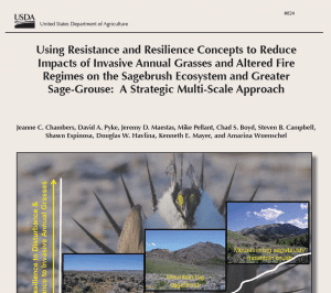
View report.
This report provides a strategic approach for conservation of sagebrush ecosystems and greater sage-grouse that focuses specifically on habitat threats caused by invasive annual grasses and altered fire regimes. It uses information on (1) factors that influence sagebrush ecosystem resilience to disturbance and resistance to invasive annual grasses and (2) distribution, relative abundance, and persistence of sage-grouse populations to develop management strategies at both landscape and site scales.
View fact sheet.
This fact sheet from the Sage Grouse Initiative discusses a new soils product that provides the ability to depict potential ecosystem resilience and resistance across the range of sage-grouse using soil temperature and moisture regimes.
View article.
This Science article reports on a growing body of research challenging the widespread notion that beetle-killed forests are more vulnerable to more severe fires than those that have escaped infestation. The findings are highlighting the complex causes of western wildfires and raising new questions about the efficacy of some fire prevention policies, such as plans to remove beetle-killed trees from vast swaths of forest.
View abstracts.
Abstracts of recent papers on climate change and land management in the West. Prepared by Louisa Evers, Science Liaison and Climate Change Coordinator, Bureau of Land Management, Oregon-Washington State Office.
View abstracts.
These abstracts of recent papers on rangeland management in the West were prepared by Charlie Clements, Rangeland Scientist, USDA Agricultural Research Service, Reno, NV.
View article.
In this news article, work by Ann Kennedy, scientist at Washington State, Susan Meyer, USFS research ecologist, and others is highlighted. Their work includes sorting through some 20,000 strains of naturally occurring soil bacteria to discover two that single out cheatgrass.
View report.
This report provides a GIS protocol for identifying strategic locations for fuel breaks to protect remaining large patches of habitat. It was prepared by The Nature Conservancy for the Western Association of Fish and Wildlife Agencies (WAFWA).
Geodatabase that accompanies the report –
File 1 (682MB)
File 2 (84.5MB)