Tools and Trainings
Access the tool.
Neighborhoods at Risk is an easy-to-use website with interactive maps, charts, and resources to help communities identify neighborhoods that may be especially vulnerable to wildfire, flooding, and extreme heat of climate change.
It is free to use and available for every community, county, and state in the nation.
View brief and access the tool.
Livestock grazing is a common use of rangelands that can be managed to support rangeland health, including the wide array of ecosystem services that benefit society from public lands and private lands. This requires careful allocation of naturally occurring forage on large landscapes for both domestic and wild herbivores. Managers know grazing can sustain rangeland health as long as they time it right and balance the duration, frequency, and intensity of the grazing. However, forage production on a single area or landscape varies significantly from year to year, which, until recently, has limited the accuracy of data available to managers when they make decisions about grazing.
Access the resources.
Virtual fence (VF) has the potential to revolutionize grazing systems by allowing dynamic control of livestock distribution and duration. The system uses invisible barriers, established by Global Positioning System (GPS) coordinates, to influence livestock movement with a combination of auditory and electrical cues without a physical fence. However, it can be also be complicated and expensive.
This digital guide was created to empowers ranchers and land managers to effectively evaluate and use VF for improved rangeland management. Explore the foundations of VF factsheets, watch the videos, access geospatial resources, and explore handouts from workshops and webinars to better understand a VF system.
Access tool.
Explore past and present landscapes from the Great Plains to the Pacific coast. This easy-to-use map uses historic and current aerial imagery to highlight how our landscapes have changed since the mid-20th century and how we can conserve our natural heritage.
Uses of the tool highlighted by Intermountain West Joint Venture.
The Western Forbs: Biology, Ecology, and Use in Restoration project is now a website.
Westernforbs.org is designed to aid seed collectors, seed growers, nurserymen, landowners, restoration practitioners, and land managers as they increase the supply and use of native forbs.
- Species menu tab – Offers complete reviews that synthesize existing research and practical experience available for western forb species. Anything reported on the biology, ecology, seed technology, and use in wildland restoration is included.
- Lookup Table menu tab – Summarizes forb species data in a searchable and filterable table. Included are the data on taxonomy, distribution, biology, ecology, seed supply development, and nursery and wildland restoration knowledge for each species.
Access the tool.
PopEquus is open-source and uses peer-reviewed information to model expected outcomes for a given population of wild horses and the cost associated with that outcome. The model can project, for example, what the population size of a given wild horse herd will be after 10 years using a fertility-control vaccine to prevent pregnancy in a proportion of mares, as well as the expected cost. BLM managers can use this information to compare different possible management strategies.
The Bureau of Land Management and the Great Basin Fire Science Exchange have partnered to offer the following Restoration of Sagebrush Ecosystems Class, see course flyer.
What: Restoration of Sagebrush Ecosystems Class
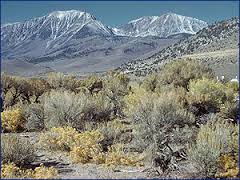
Why: Gain foundational knowledge and skills needed to plan, implement, and evaluate management strategies and restoration practices to address threats to sagebrush ecosystems from landscape to local scales.
Who can attend: DOI and Non-DOI Land Management Professionals
When: 3-7 March 2025
Where: Hyatt Place South Reno, NV
How: DOI link Course: Restoration of Sagebrush Ecosystems (doi.gov), non-DOI registration instructions
Access Firetopia.
Land use planning tool from Headwaters Economics. Includes information on:
- Community planning
- Land development
- Building and fire codes
- Fuels treatment
- Funding and engagement
Access tool.
The Wildland Fire Trends Tool (WFTT) is a data visualization and analysis tool that calculates and displays wildfire trends and patterns for the western U.S. based on user-defined regions of interest, time periods, and ecosystem types. Users can use the tool to easily generate a variety of maps, graphs, and tabular data products that are informative for all levels of expertise. The WFTT provides information that can be used for a wide range of purposes, from helping to set agency fire management objectives to providing useful information to scientists, interested public, and the media.
Access tool.
Monitoring Trends in Burn Severity (MTBS) includes all fires 1000 acres or greater in the west and 500 acres or greater in the east. The extent of coverage includes the continental U.S., Alaska, Hawai’i and Puerto Rico. MTBS data are freely available to the public.


