Monitoring

Reliability of satellite-based vegetation maps for planning wildfire-fuel treatments in shrub steppe
View article.
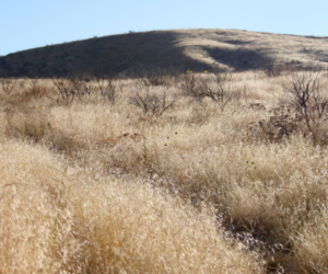
We compared commonly used, publicly available vegetation cover and fuels maps, specifically the Rangeland Analysis Platform (RAP) and LANDFIRE, with field-based assessments at two U.S. National Parks dominated by sagebrush steppe: City of Rocks National Reserve and Craters of the Moon National Monument and Preserve. Plant-community composition and fuels measured at ∼1700 field locations spanning ∼300,000 ha revealed that 1) RAP generally underestimated each vegetation cover type where the cover was actually abundant, and conversely overestimated cover types where they were actually scarce, and 2) there was considerable disagreement in fuel-bed maps derived from LANDFIRE compared to field observations. As a result, there were substantial discrepancies in the spatial patterning of wildfire behavior estimated from the fire-spread model FLAMMAP when parameterized with LANDFIRE compared to field-based fuel-bed maps created from Random Forests models. Reliable maps of vegetation cover and fuel conditions are needed to help guide fuels and invasive species management, especially given recent increases in pre- and post-fire treatments in arid and semiarid landscapes. The costs associated with poorly informed fuel reduction may greatly exceed the costs of field-based vegetation and fuels inventory to inform effective design of vegetative fuels treatments.
Webinar registration.
Speaker: Daryn Dockter, LANDFIRE Technical Lead, TSSC, EROS

Webinar join link.
The NRI program collects and produces scientifically credible information on the status, condition, and trends of land, soil, water, and related natural resources on the nation’s non-federal lands. It is the largest field-based survey of natural resources in the world. Inventories of natural resources have been conducted for over 65 years on non-Federal lands. For rangelands, the 12 current inventory and assessment protocols were developed in a collaboration of federal agencies, were tested for several years across the continental United States, and were set in 2004. The same set of protocols was applied to Federal rangelands beginning in 2009. This presentation describes the protocols and some of the new relevant information being generated by this longitudinal statistical study of on-site rangeland inventory.
View article.
The rate of change in invasive annual grass cover describes the trajectory of invasion. This information can be used to fine-tune priority locations and strategies for invasive species treatments. We identified locations with positive, neutral, negative, and variable rates of change. Although rates of change have accelerated, there were many locations with a consistent neutral rate of change in cover. High positive rates of change frequently preceded high invasive annual grass cover, and locations that had low cover rarely had a history of high positive rates of change. We identified potential management opportunities by combining rates of change in cover and percent cover data, illustrating both invasion severity and trajectory. We applied these potential opportunities to a map of the sagebrush biome using example thresholds. This map identifies locations that could be prioritized for different management goals and shows how those areas align with the Sagebrush Conservation Design management

The US Geological Survey Land Management Research Program and the Great Basin Fire Science Exchange teamed up to bring you updates in sagebrush, fire, and wildlife related research. On 3/6/2025, USGS researchers, Matt Rigge, Martin Holdrege, and Shawn O’Neil shared research on vegetation trends and their relationships to climate, invasion, and disturbance, Gregor Siegmund, Alice Stears, Mike Duniway, and Gayle Tyree shared their latest research on planning and predicting succss of restoration treatments, and Will Janousek shared science on elk management. Below are the webinar recording and resources associated with each presentation.
To view a complete list of resources (completed and planned), please view the program for this slate of presentations.
3/6 – Climate, vegetation trends, and big game
Rangeland Condition Monitoring Assessment and Projection (RCMAP) vegetation trend summaries
Project webpage
Multi-Resolution Land Characteristics Consortium
RCMAP fractional component time-series data across western North America (1985-2023)
Integrating climate, sagebrush ecological integrity, and grazing
Project webpage
Observed wildfire frequency, modelled wildfire probability, climate, and fine fuels across the big sagebrush region in the western US
Influence of future climate scenarios on habitat and population dynamics of greater sage-grouse
Project webpage
Understanding and forecasting environmental controls over plant establishment in sagebrush ecosystems to enhance restoration success
Project webpage
Treatment and post-fire assessment tools for management of the sagebrush ecosystem
Project webpage
Science to support elk management efforts to reduce chronic wasting disease (CWD) risk
Project webpage
The US Geological Survey Land Management Research Program and the Great Basin Fire Science Exchange teamed up to bring you updates in sagebrush, fire, and wildlife related research. On 2/20/2025, USGS researchers, Rob Arkle, Doug Shinneman, and Michelle Jeffries, shared research on monitoring and planning, Adam Noel and Sarah Halperin shared their latest research on pinyon-juniper treatments and decision support. Below are the webinar recording and resources associated with each presentation.
To view a complete list of resources (completed and planned), please view the program for this slate of presentations.
2/20 – Monitoring, pinyon-juniper, and fuels management
Webinar recording
Planning for conservation delivery success: Linking biome-wide Sagebrush Conservation Design to local treatment planning by leveraging landscape restoration outcomes
Land Treatment Exploration Tool (LTET)
Technical transfer tools for the Nevada and Oregon rangeland monitoring project (NORMP)
Oregon rangeland monitoring program: SageCon
Rapid and Other Assessment and Monitoring Methods (ROAM) project
ROAM project website
Pinyon-juniper treatments for minimizing climate and fire vulnerability
Project website
Most PJ woodland species distributions projected to shrink under climate change
Data of estimated environmental suitability of PJ species under various climate scenarios
Earth Engine App with PJ projected distributions
Synthesizing scientific information on treatment and natural disturbance effects on pinyon-juniper woodlands and associated wildlife habitat
Project website
Ecological effects of PJ removal in the western US: A synthesis (2014-2021)
The US Geological Survey Land Management Research Program and the Great Basin Fire Science Exchange teamed up to bring you updates in sagebrush, fire, and wildlife related research. On 2/6/2025, USGS researchers, Stephen Boyte and Morgan Roche shared their latest research on cheatgrass and fine fuels, Bryan Tarbox and Erica Christensen shared research on restoration treatment effectiveness, and Cam Aldridge and Cara Applestein shared research on monitoring and predictions to help restoration. Below are the webinar recording and resources associated with each presentation.
To view a complete list of resources (completed and planned), please view the program for this slate of presentations.
Individual presentations and associated resources, within the project webpage with links to data and publications:
Develop annual herbaceous percent cover maps in near-real time
Project webpage
Exotic annual data
Proliferation of fine fuels: Assessing under future climatic conditions
Optimizing Sagebrush Restoration project webpage
Proliferations project webpage
Optimizing sagebrush restoration and management actions to increase connectivity within the Sagebrush Conservation Design
Project webpage
Prioritizing Restoration of Sagebrush Ecosystems Tool (PreSET) decision-support tool
Leveraging soil, vegetation, fire, and land treatment data to inform restoration across the sagebrush biome
The Sagebrush Conservation Design
Assessing cheatgrass treatment efficacy across the sagebrush biome
Project webpage
Sagebrush recovery modeling website and associated projects
Sagebrush recovery projections layers
Leveraging soil, vegetation, fire, and land treatment data to inform sagebrush restoration
Simulating trends in land health components under treatment scenarios and Sagebrush Conservation Design
Project webpage
Sagebrush biome-wide vegetation change monitoring and warning system
Project webpage
Vectors of annual grass invasion – Roche et al. Predicting reburn risk to restoration investments
Projects webpage
This special issue of Rangeland Ecology and Management is dedicated to applying the Sagebrush Conservation Design (SCD) to improve conservation outcomes across the sagebrush biome in the face of pervasive ecosystem threats.
Articles included:
State of the sagebrush: Implementing the Sagebrush Conservation Design to save a biome
Closing the conservation gap: Spatial targeting and coordination are needed for to keep pace with sagebrush losses
Climate change amplifies declines in sagebrush ecological integrity
Well-connected core areas retain ecological integrity of sagebrush ecosystems amidst overall declines 2001–2021
Spatial prioritization of conifer management to defend and grow sagebrush cores
A strategic and science-based framework for management of invasive annual grasses in the sagebrush biome
Modeling cropland conversion risk to scale-up averted loss of core sagebrush rangelands
Characterizing wildfire risk for the Sagebrush Conservation Design
An assessment of conservation opportunities within sagebrush ecosystems of US National Parks and Wildlife Refuges
Tool to promote stepping down the Sagebrush Conservation Design to local conservation planning
Exploring the sage grouse initiative’s role in defending and growing sagebrush core areas
Satellite remote sensing to assess shrubland vegetation responses to large-scale juniper removal in the northern Great Basin
Cooperative conservation actions improve sage-grouse population performance within the bi-state distinct population segment
Evaluating the Sagebrush Conservation Design Strategy through the performance of a sagebrush indicator species
How a Sagebrush Conservation Strategy benefits rangeland birds
Carbon Security Index: Novel approach to assessing how secure carbon is in sagebrush ecosystems within the Great Basin
Using technical transfer to bridge science production and management action
Assessing conservation readiness: The where, who, and how of strategic conservation in the sagebrush biome
Where do we go from here with sagebrush conservation: A long-term perspective?
There is no hope without change: A perspective on how we conserve the sagebrush biome
View article.
We developed a framework for identifying which biotic traits would provide the best initial indication of longer-term target restoration goals and applied the framework to restoration drill-seedings of deep-rooted perennial bunchgrasses (DRPBGs) used to rehabilitate and restore semiarid rangelands threatened by exotic annual grasses (EAGs, e.g. cheatgrass) and the recurrent wildfire that EAGs cause. Initial traits measured included cover, basal diameter, height, and density (#plants/area) of DRPBGs and cover of EAGs and Sandberg bluegrass (Poa secunda, POSE, a disturbance-adapted perennial). The longer-term target objective was ≥25 % DRPBG cover and ≤13 % EAG cover by the 5th year following drill-seedings. Measurements were made on 112 plots spanning 113,000 ha in sagebrush steppe on the Soda wildfire scar, in the Northern Great Basin, USA. Traits of DRPBGs tended to be uncorrelated with one another, thus each was informative in describing vegetation condition. Where DRPBG cover was initially >17 %, it tended to become >25 % by the 5th-year post-seeding. In plots that overcame an initial risk of not meeting the target objective (i.e. <17 % initial DRPBG cover), DRPBG tended be large DRPBGs (>22.8 cm height) and plots also had >7 % cover of POSE. Additional “sets” of initial vegetation traits were also predictive of longer-term restoration success or failure. Restoration drill-seeding of DRPBGs is a key but varied-outcome tool for breaking the exotic grass-fire cycle, and, contrary to a conventional tendency to rely on a limited number of mean traits such as % cover, a suite of biotic traits appears necessary to monitor to reliably know if trials are likely to yield success.