Webinar
Webinar registration.
Learn about new geospatial data products to support wildfire planning and response including national fuel treatments, fire response districts and communities mapping.
Webinar registration.
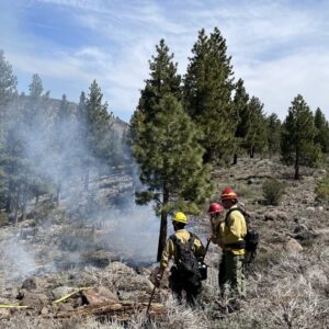
The cascading effects of post wildfire can bring more devastation to an already battered community. Utah’s Post Wildfire Mitigation Team, established in 2019, is led by the Utah Division of Emergency Management. It brings together Federal, State, private and local partners to meet with communities throughout Utah affected by wildfires. The team discusses actions, makes available resources, and identifies hazard mitigation opportunities to assist communities with the cascading events that can occur post wildfire. Bringing a “One stop shop” to communities.
Webinar registration.
Are you planning for smoke preparedness and mitigation in your community and looking to embed that work into your Community Wildfire Protection Plan? Join our discussion and talk with experts about tips and resources for integrating smoke considerations into your CWPPs.
Webinar registration.
Are you thinking about integrating your Community Wildfire Protection Plan update with an All-Hazards Mitigation plan or other local plans? Join our discussion and talk with experts about tips and resources for how to crosswalk these plans effectively. This is the first of a three-part series that will provide a deep dive into developing the next generation of CWPPs.
Webinar registration.
Speaker: Daryn Dockter, LANDFIRE Technical Lead, TSSC, EROS

Webinar recording.
Communities have long used landscaping codes to reduce water consumption, but a few stand-out cities have crafted codes that pair water-wise goals with fire-wise principles. Join experts for an hour-long webinar exploring how these double-duty landscaping codes can reduce fire risk and encourage water conservation in your community.
Webinar recording.
The Southwest Ecological Restoration Institutes (SWERI) established the ReShape program in response to feedback from policymakers, land managers, and researchers. ReShape (reshapewildfire.org) compiles and displays national-scale data on forest treatments and wildfires through the Treatment and Wildfire Interagency Geodatabase (TWIG), a user-friendly, collaborative, and open-access decision support tool. Research efforts focus on four key areas: social science for collaborative decision-making, biophysical effects of forest treatments, data science for large dataset analysis, and economic assessments led by the Conservation Economics Institute. At this critical stage, ReShape is fostering dialogue on TWIG’s effectiveness while refining the tool to better support wildfire risk reduction efforts.
This webinar will provide a tool demonstration, lessons from case studies, and a Q&A session to help researchers, land managers, and graduate students access and incorporate nationwide wildfire and fuel treatment data through the TWIG into their analyses for better understandings of fuel treatment effectiveness across boundaries.
Webinar registration.
Matt Reeves, (Fuel and Forage), US Forest Service, Rocky Mountain Research Station
Webinar registration.
Hosted by the Montana Forest Collaboration Network
OBJECTIVES:
– Discuss the characteristics of cross-boundary projects and how they increase efficiency and effectiveness when managing priority landscapes
– Inspire more cross-boundary work in Montana
– Build awareness of how collaborative partners can support cross-boundary projects
– Discuss the mechanics of planning and implementing forest management projects across land management boundaries
– Share examples of cross-boundary projects in Montana