Webinar

Webinar details and join link.
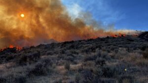
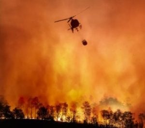
Wildfires are becoming more destructive as burned area increases and as more homes are built in the wildland-urban interface, but it is unclear how these patterns are affected by changing wildfire behavior in different fuel types. To better understand changing patterns of wildfire destruction, we mapped buildings exposed to and destroyed by wildfires in the conterminous U.S. from 2000-2020. From these maps, we determined that the probability of an exposed building being destroyed by wildfire has more than tripled over the past two decades, and that more wildfire destruction is occurring in forests relative to grass and shrublands. Understanding these changing patterns can help us design more effective strategies to mitigate risk.
Webinar registration.
Learn about new geospatial data products to support wildfire planning and response including national fuel treatments, fire response districts and communities mapping.
Webinar registration.
Scott Bergen, Senior Wildlife Research Biologist, Idaho Department of Fish and Game

Webinar registration.
Informative webinar on fire-resistant plants and commonly found species in New Mexico. Also, learn more about effective landscaping techniques to help reduce wildfire risk and protect your property.
Webinar registration.
Behave7 has just been released! We will discuss how Behave v7 differs from BehavePlus v6 by highlighting the Surface, Surface/Crown, Surface/Mortality, and Surface/Contain modules and enhancements that will be included in the next few releases in 2025-2026. This webinar will be useful for both burn bosses and RX-300 cadres.
Webinar registration.
This webinar will discuss how Behave v7 differs from BehavePlus v6 by highlighting the Surface and Surface/Crown modules and enhancements that will be included in the next few releases in 2025-2026. This webinar will be most useful for fire analysts, S-390 cadres, and S-490 cadres.
Webinar registration.
Title: How LANDFIRE EVT contributes to the estimation of forage and seasonal range in Idaho: A perspective through time 2003-2023
Speaker: Scott Bergen, Senior Wildlife Research Biologist, Idaho Department of Fish and Game
Summary: Idaho Dept of Fish and Game uses LANDFIRE extant vegetation type databases 2001-2023 to estimate seasonal range analyses of Idaho’s big game species. Using mule deer as a focal species, IDFG has developed multi-temporal analyses that use GPS data that has been collected from deployed location collars through time (2003- present). One of the most influential factors in determining mule deer summer range is the quality of forage where IDFG reclassifies EVT vegetation data into forage type data. This data, along with several other graphic data are ‘mined’ using machine-learning algorithms to estimate both winter and summer range conditions for a seasonally migratory species and their conservation management. We will discuss how LANDFIRE data is used, some of the problems and inconsistencies found with LANDFIRE (2001-2023), and how LANDFIRE is an invaluable resource for the management of this iconic western species.

Webinar recording (43:56)
Join the LANDFIRE Office Hour as Nicole Vaillant (Fire Management Specialist, RMRS, Fire Lab, Wildland Fire Management RD&A) discusses how conducting a Quantitative Wildfire Risk Assessment (QWRA) can enhance land management by evaluating wildfire risk and benefits across a landscape. This information can help plan fuel treatments, suppression responses, and fire effects monitoring. QWRA uses LANDFIRE data to model fire behavior, including fire likelihood, intensity, and impacts efficiently. The Interagency Fuel Treatment Decision Support System (IFTDSS) includes a workflow to make the QWRA process manageable and time efficient.