Decision Support
View report.
This report provides an updated process for mapping relative habitat suitability and management categories for sage-grouse in Nevada and northeastern California.
Updates include:
- adding radio and GPS telemetry locations from sage-grouse monitored at multiple sites during 2014 to the original location dataset beginning in 1998
- integrating output from high resolution maps (1–2 m2) of sagebrush and pinyon-juniper cover as covariates in resource selection models
- modifying the spatial extent of the analyses to match newly available vegetation layers
- explicit modeling of relative habitat suitability during three seasons (spring, summer, winter) that corresponded to critical life history periods for sage-grouse (breeding, brood-rearing, over-wintering)
- accounting for differences in habitat availability between more mesic sagebrush steppe communities in the northern part of the study area and drier Great Basin sagebrush in more southerly regions by categorizing continuous region-wide surfaces of habitat suitability index (HSI) with independent locations falling within two hydrological zones
- integrating the three seasonal maps into a composite map of annual relative habitat suitability
- deriving updated land management categories based on previously determined cut-points for intersections of habitat suitability and an updated index of sage-grouse abundance and space-use (AUI)
- masking urban footprints and major roadways out of the final map products.
View article.
This study analyzed seasonal variation in the relative availability of soil water for the years 2001, 2004, and 2007, representing respectively, low, moderate, and high rankings of areas burned. For these selected years, the model predicted where forest fires >1 km occurred and did not occur at ~100,000 randomly located pixels with an average accuracy of 69%. The model identified four seasonal combinations, most of which included exhaustion of available water storage capacity during the summer as critical; two combinations involving antecedent conditions the previous spring or fall accounted for 86% of the predicted fires. The approach introduced in this paper can help identify forested areas where management efforts to reduce fire hazards might prove most beneficial.
Access app and tool.
The Sage Grouse Initiative Interactive Web App is a tool to catalyze and improve habitat conservation efforts across the western United States. It presents cutting-edge geospatial data covering 100 million acres, which helps visualize, distribute, and interact with information about the sagebrush-steppe ecosystem.
Access tool.
The USGS Science Locator tool provides a way to search for published research locations in the Great Basin.
Access database.
The GBRMP Consortia Database provides a way to easily identify the various partnership groups in the Great Basin and obtain a quick reference to their goals, points of contact, and relationships.
Access LANDFIRE tools.
LANDFIRE is a shared program between the wildland fire management programs of the USDA-FS and DOI, providing landscape scale geo-spatial products to support cross-boundary planning, management, and operations. It provides over 20 national geo-spatial layers (e.g. vegetation, fuel, disturbance, etc.), databases, and ecological models that are available to the public for the US and insular areas.
View an introductory LANDFIRE video.
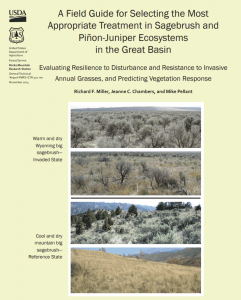
View field guide.
This field guide identifies seven primary components that largely determine resilience to disturbance, as well as resistance to invasive grasses and plant succession following treatment of areas of concern. An evaluation score sheet is included for rating resilience to disturbance and resistance to invasive annual grasses and the probability of seeding success.
View guide.
This planning guide is the outcome of an international collaboration of researchers and practitioners/field managers working in communities at risk of wildfire in three countries. Initially, the team of social scientists from Australia, Canada, and the United States utilized the collective research literature to examine factors that influence stakeholder trust.
Access dashboard.
The Great Basin Weather and Climate Dashboard came about from a need to help stakeholders locate the weather and climate information they need to make decisions related to the current drought in the Great Basin. The Dashboard is a joint effort by the Western Regional Climate Center, California and Nevada Applications Program,the USDA Farm Service Agency and the Great Basin LCC.

Access app.
SoilWeb Apps from the UC Davis California Soil Resource Lab provide access to USDA-NCSS detailed soil survey data (SSURGO) for most of the United States.