Decision Support
Access database.
The GBRMP Consortia Database provides a way to easily identify the various partnership groups in the Great Basin and obtain a quick reference to their goals, points of contact, and relationships.
Access LANDFIRE tools.
LANDFIRE is a shared program between the wildland fire management programs of the USDA-FS and DOI, providing landscape scale geo-spatial products to support cross-boundary planning, management, and operations. It provides over 20 national geo-spatial layers (e.g. vegetation, fuel, disturbance, etc.), databases, and ecological models that are available to the public for the US and insular areas.
View an introductory LANDFIRE video.
View field guide.
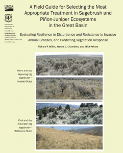
This field guide identifies seven primary components that largely determine resilience to disturbance, as well as resistance to invasive grasses and plant succession following treatment of areas of concern. An evaluation score sheet is included for rating resilience to disturbance and resistance to invasive annual grasses and the probability of seeding success.
View guide.
This planning guide is the outcome of an international collaboration of researchers and practitioners/field managers working in communities at risk of wildfire in three countries. Initially, the team of social scientists from Australia, Canada, and the United States utilized the collective research literature to examine factors that influence stakeholder trust.
Access dashboard.
The Great Basin Weather and Climate Dashboard came about from a need to help stakeholders locate the weather and climate information they need to make decisions related to the current drought in the Great Basin. The Dashboard is a joint effort by the Western Regional Climate Center, California and Nevada Applications Program,the USDA Farm Service Agency and the Great Basin LCC.

Access app.
SoilWeb 2.0 App update released in June 2019
SoilWeb Apps from the UC Davis California Soil Resource Lab provide access to USDA-NCSS detailed soil survey data (SSURGO) for most of the United States.
Climate change, forests, fire, water, and fish: building resilient landscapes, streams, and managers
View report.
This report describes the framework of how fire and climate change work together to affect forest and fish communities. Learning how to adapt will come from testing, probing, and pushing that framework and then proposing new ideas. The western U.S. defies generalizations, and much learning must necessarily be local in implication. This report serves as a scaffold for that learning. It comprises three primary chapters on physical processes, biological interactions, and management decisions, accompanied by a special section with separately authored papers addressing interactions of fish populations with wildfire.
Access NEPAssist tool.
NEPAssist is a tool that facilitates the environmental review process and project planning in relation to environmental considerations. The web-based application draws environmental data dynamically from EPA Geographic Information System databases and web services and provides immediate screening of environmental assessment indicators for a user-defined area of interest. These features contribute to a streamlined review process that potentially raises important environmental issues at the earliest stages of project development.

Access NICE Net.
NICE Net is a weather station network measuring weather variables to assess climate and reference evapotranspiration across the state of Nevada. The focus of the NICE Net is to measure and provide climate data that are derived from agricultural areas of Nevada for estimating irrigation water requirements.
View article.
Three models were evaluated in this study: CALPUFF, DAYSMOKE and CMAQ during different prescribed burn and wildfire episodes occurring throughout the southeastern US. Results suggested that CALPUFF could not be determined to be a suitable model for simulating the air quality impacts of fires. Model evaluation indicated that DAYSMOKE can be turned into a reliable a short‐range smoke‐impact prediction tool for land managers. On a regional scale, PM2.5 impacts of prescribed burns and wildfires are best predicted by air quality models such as CMAQ.