Fuels & Fuel Treatments

View synthesis.
This review spanned 1976 to 2013 and used thematic coding to identify key factors that affect the decision to manage a wildfire. A total of 110 descriptive factors categories were identified. These were classified into six key thematic groups, which addressed specific decision considerations. This nexus of factors and decision pathways formed what we describe as the ‘Managed Fire Decision Framework’, which contextualizes important pressures, barriers, and facilitators related to managed wildfire decision-making. The most prevalent obstacles to managing wildfire were operational concerns and risk aversion. The factor most likely to support managing a fire was the decision maker’s desire to see the strategy be implemented. Ultimately, we found that the managed fire decision-making process is extremely complex, and that this complexity may itself be a barrier to its implementation.

View article.
Relative to unburned sites, we found that burned sites had lower stem density and had lower proportions of recently dead trees (for stems ≤47.5 cm dbh) that presumably died during the drought. Differences in recent tree mortality among burned and unburned sites held for both fir (white fir and red fir) and pine (sugar pine and ponderosa pine) species. Unlike earlier results, models of individual tree mortality probability supported an interaction between plot burn status and tree size, suggesting the effect of prescribed fire was limited to small trees. We consider differences with other recent results and discuss potential management implications including trade-offs between large tree mortality following prescribed fire and increased drought resistance.
View article.
Treatments in cooler and moister woodland sites had more positive effects on sagebrush recruitment and perennial grass cover, less negative effects on sagebrush intraspecific interactions, and smaller increases in annual grass cover indicating potential increases in resilience to fire. In warmer and drier invasion sites, reductions in woody fuels resulted in lack of sagebrush recruitment, disruption of sagebrush intraspecific interactions, and progressive increases in annual grass indicating reduced resilience to fire and resistance to invaders.

Fire Aware. Fire Prepared- Wildfire Wednesday’s webinar series presented by Oregon State University Extension. Webinar recordings are available at the Fire Program website.
Fire Aware. Fire Prepared. Wildfire Wednesday’s webinar series hosted by Oregon State University Extension recordings are available on the Fire Program website.
View article.
The encroachment of pinyon-juniper woodlands into sagebrush habitat in the Great Basin Ecoregion of the western USA, represents a potential source of habitat degradation for sagebrush-associated wildlife species. To restore sagebrush habitat, managers are conducting large-scale conifer removal efforts within the Great Basin, particularly within Greater Sage-Grouse (Centrocercus urophasianus) priority areas for conservation. Such largescale habitat modification efforts may result in unintended ecological trade-offs for wildlife. To investigate these trade-offs, we used community science data to develop species distribution models for two sagebrush and three pinyon-juniper associated bird species of conservation concern in the Great Basin. We evaluated the predictive performance of our models with an independent dataset of presence locations derived from systematic monitoring programs. We then simulated conifer removal across the Great Basin and mapped habitat gains and losses for our study species. Despite differing land cover associations, 31%-51% of suitable habitat for our study species coincided with Greater Sage-Grouse priority areas for conservation. Our conifer removal scenario increased suitable habitat by 6%-17% for sagebrush associates and reduced habitat by 11%-41% for pinyon-juniper associates. We identified areas of the Great Basin where conifer removal expanded habitat for sagebrush associates without concurrent habitat loss for pinyon-juniper associates. Our results provide guidance for conducting vegetation management in the Great Basin while addressing the habitat needs for multiple focal species. Our methods, which use freely available community science data and geospatial layers, can easily be transferred to other species and ecoregions.
Webinar recordings.
Monday, December 6: Forest and Rangeland Livelihoods
Leveraging demand for renewable energy and innovative bioproducts to facilitate forest restoration, presented by Nate Anderson
What happened to wood products markets in 2020 and 2021 in the United States?, presented by Jeff Prestemon
Managing wolves and livestock on national forests in the West, presented by Susan Charnley
Tuesday, December 7: Protecting Ecosystem Services
Human ecology mapping: Capturing diverse forest benefits and landscape interactions for use in planning and decision-making, presented by Lee Cerveny
What’s a canopy worth? Using i-Tree to understand the value of trees, presented by Alexis Ellis
Agroforestry: Tools for working across the landscape, presented by Gary Bentrup, Kate MacFarland, Matthew Smith, Richard Straight
Wednesday, December 8: Bounty Beneath Our Feet
Why is biochar so important?, presented by Debbie Page-Dumroese
Establishing pollinator habitat in log landings after timber sales begins with restoring the soil, presented by John Kabrick
Soil organic carbon, presented by Andy Coulter and Stephanie Connolly
Thursday, December 9: Urban Interfaces
A shared stewardship approach to wildland fire mitigation in Eastern Oklahoma, presented by Cassandra Johnson Gaither
Urban forestry, presented by Natalie van Doorn
Fire WUI urban communities, presented by Francisco Escobedo
Friday, December 10: Getting Outside
Managing winter recreation and sensitive species on Colorado’s public lands: Do humans and Canada lynx select the same habitat?, presented by Lucretia Olson
Considering the benefits of recreation in program reporting and decision-making, presented by Eric White
Latinix outdoor recreation, presented by Jose Sanchez
Meeting website.
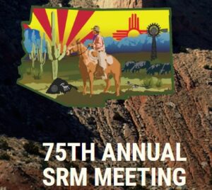
Join us in the heart of New Mexico for the 75th Annual SRM Meeting. The beautiful high desert rangelands, diverse cultures, authentic art, and painted skies of Albuquerque will make for a great meeting.
View article.
We used a sample of 30 future fire seasons to understand how the plan might be impacted by wildfires and treatment. We found that once fully implemented more than 20% of simulated fires on national forests overlapped fuel treatments, and that roughly 20% of the projects were burned prior to their implementation, suggesting that any plan will undergo significant revision during implementation. Treated areas intersected by wildfire accounted for twice the exposure than non-treated areas that also burned. The study demonstrates the use of scenario planning to design a fuel treatment program that targets wildfire exposure to developed areas, and the methods pave the way for expanded use of scenario planning science to analyze and communicate large scale expansion of current forest and fuel management initiatives.
View article.
We first analyzed interannual trends in six phenological measures as a baseline. We then demonstrated how including annual-resolution predictors can provide more nuanced insights into measures of phenology between plant communities and across the ecoregion. Across the study area, higher annual precipitation increased both peak and season-long productivity. In contrast, higher mean annual temperatures tended to increase peak productivity but for the majority of the study area decreased season-long productivity. Annual precipitation and temperature had strong explanatory power for productivity-related phenology measures but predicted date-based measures poorly. We found that relationships between climate and phenology varied across the region and among plant communities and that factors such as recovery from disturbance and anthropogenic management also contributed in certain regions. In sum, phenological measures did not respond ubiquitously nor covary in their responses. Nonclimatic dynamics can decouple phenology from climate; therefore, analyses including only interannual trends should not assume climate alone drives patterns.