Fuels & Fuel Treatments

In this Utah State University study, we began by reviewing published academic literature, focusing on the few studies conducted in Utah. To dig deeper, we focused on concerns raised in Summit County, where prescribed burning has drawn considerable public attention and occasional opposition. Finally, we conducted a preliminary online survey of wildland-urban interface (WUI) residents across the state to assess initial levels of concern and/or support for prescribed fire.
View booklet.
The reciprocal nature of our human interactions with our natural environment can be viewed through the lens of fire management in the West by federal, state, and private land managers. A wildfire’s impact is not affected by the presence of a geopolitical boundary, it is still inherently a natural process fueled by relatively well-understood dynamics. Yet, changing climate conditions such as extended heat waves, droughts, shifts in rainfall patterns or types of precipitation are changing how fire behaves in the West. From a Tribal member’s perspective, these climatic conditions, social development, and ecological degradation are all connected events with relatively predictable consequences. Because there is a reciprocal relationship with our environment, we are collectively accountable for the consequences of our choices in a modern context through a changing climate.
View guide. (Click on the word “guide” to view it.)
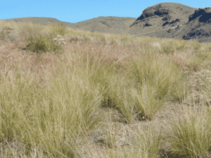
A photo guide for use in classifying fire behavior fuel models from the Scott and Burgan (2005) library that are common to the sagebrush steppe of the American west. The goal of this guide is to enable the quick and easy classification of fuel models in sagebrush steppe to –
- enhance the mapping of fuel beds in an increasingly fire prone region,
- guide the evaluation of fuel and post-fire restoration treatments, and
- improve our understanding of fuel conditions during times of the year when wildfire preparedness is greatest (i.e. hot and dry).

Webinar recording.
The use of prescribed fire to manage ecosystems is increasing across the United States, but climate change threatens to impact future opportunities for prescribed fire as a result of changes in meteorological conditions and fuels. I will discuss the results of a recent study which combined prescription information from 80 sites across the US with LANDFIRE fuels data and downscaled future climate projections to evaluate how climate change will impact future availability of burn days. Our results indicate that rising maximum temperatures may lead to decreases in burn days across the eastern US, while rising minimum temperatures and decreasing wind speeds may lead to increased opportunities for prescribed fire in the northern and northwestern US.
Webinar recording.
Wildland fire managers require an expanded toolbox for decision support in the context of an increasingly novel fuel and fire environment complicated by a changing climate, invasive species encroachment, and rapid increase in wildland-urban interface in many areas within the U.S. Terrestrial Laser Scanning (TLS) offers an efficient, cost-effective, and powerful tool for characterizing high resolution, sub-canopy forest and fuel structural conditions with the simple press of a button. In this panel discussion, TLS subject matter experts from both research and operations will share their efforts and practical applications of TLS and other 3D wildland fuels characterization tools for improved wildland fire planning, fire effects monitoring, and decision support.

View article.
Strategic development and implementation of burn boss training may increase the likelihood that burn bosses can safely and effectively implement prescribed burns. This article presents a case study for applying key adult learning methods to improve training effectiveness that can be applied to other training topics in and outside wildland fire management.
Webinar recording.
The California Canyon Fire Experiment is the first large-scale field experiment that observed fire eruption. The experiment was conducted in a steep canyon near Salinas, CA on 24 October 2022. A large suite of in situ and remote sensing instruments were deployed including micrometeorological towers, Doppler radar and lidar and airborne infrared imaging systems. The experiment was designed to allow a head fire to spread freely up a canyon under weak ambient winds to investigate the mechanisms of fire eruption. Preliminary results indicate that fire eruption occurred after the fire front reached the upper region of the canyon and fire spread was dominated by fire-induced in-drafts measured by Doppler lidar. This presentation will describe the goals of the experiment, experimental design, the phenomena sampled, the instruments used, and preliminary results.
View article.
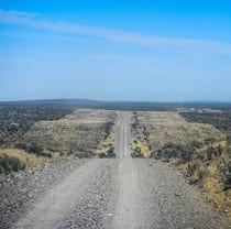
Abundances of dominant invaders, cheatgrass and Russian thistle, were measured along treated and neighboring untreated edges in 40 paired plots along ∼61 km of 60-m wide fuel breaks. Fuel breaks were constructed using a variety of shrub-cutting and herbicide applications 1–4 yr before measurement. Generalized linear mixed effect models revealed that fractional cover significantly increased in treated compared with untreated areas by 0.02–0.12 for cheatgrass and 0–0.06 for Russian thistle within 9 m of treatment boundaries (on a scale of 0-1). We neither detected increased invasion in adjacent and untreated areas nor gradients of increasing invasion with proximity to treatment boundaries. Although these findings reveal invasions that were otherwise undetected across the entire 60 m width of fuel breaks, invasion levels did not surpass nominal management thresholds for fire behavior or risk of conversion to annual grasslands.
View brief.
An extreme multi-year drought with extensive bark beetle outbreaks in California from 2012 to 2016 killed an estimated 147 million trees. This included ponderosa pine, incense cedar, white fir, and pinyon pine, rapidly changing forests over vast areas. Recently published work by Rocky Mountain Research Station (RMRS) researchers Sharon Hood and Charlotte Reed found that major tree mortality events like these increase surface and canopy fuels— dead needles, branches, and logs— which may result in more extreme forest fires and increased emissions when these areas burn. “Hopefully, this research heightens awareness about how quickly our forests can change under extreme mortality events and the potential long-lasting hazards that are created,” says Hood.
View article.
Increasing impacts from wildfires are reshaping fire policies worldwide, with expanded investments in a wide range of fuel reduction strategies. In many fire prone regions, especially in the Mediterranean basin, fuel management programs have relied on fuel break networks for decades to facilitate fire suppression and reduce area burned and damage. By contrast, on the fire prone federal forests in the western United States, fuel management is guided primarily by landscape restoration goals, including improving fire resiliency such that wildfires can be managed for ecological benefit, and suppression is used more as a tool to shape burn patterns and less to extinguish fires. New policies in both fire systems are now calling for hybrid approaches that rely on both types of investments and efficient allocation of alternative spatial treatment patterns: linear networks versus patches across the landscape. However, studies that combine these strategies and examine alternative co-prioritization outcomes and potential synergies are largely non-existent. Here, we analyzed scenarios for implementing both types of treatments in concert while varying the prioritization metrics for one type or the other on a western United States national forest.