Fuels & Fuel Treatments
View fact sheet, pg. 68.
This fact sheet discusses consequences and options for woody plant fuel reduction in Wyoming big sagebrush plant communities of the Intermountain West.
View all topics reviewed in the Fact Sheet series.
Individual fact sheets comprising the Information and tools to conserve and restore Great Basin ecosystems – Factsheet Series are available below.
No. 1- Putting resilience and resistance into practice
No. 2- Limiting medusahead invasion and impacts in the Great Basin
No. 4- Conifer removal in the sagebrush steppe: The why, when, where, and how
No. 6- Wind erosion following wildfire in Great Basin ecosystems
No. 7- Post-fire grazing management in the Great Basin
No. 8- Establishing big sagebrush and other shrubs from planting stock
No. 9- Assessing fuel loads in sagebrush steppe and PJ woodlands
No. 10- Seeding big sagebrush successfully on Intermountain rangelands
No. 11- Assessing impacts of fire and post-fire mitigation on runoff and erosion from rangelands
No. 12- Management of aspen in a changing environment
No. 13- Woody fuels reduction in Wyoming big sagebrush communities
No. 14- Seeding techniques for sagebrush community restoration after fire
View report.
This project quantifies the effects of fuel treatments and previously burned areas on daily fire management costs, as well as summarizes recent encounter rates between fuel treatments and
wildland fires across the conterminous United States. Unexpectedly, we found that encounters with fuel treatments and previous fires increase daily fire management costs. Managers working in the field validated the concept suggesting that fuel treatments and previous fires are often areas where suppression efforts are applied in greater force.
View webinar recording.
Greater sage-grouse have declined since the mid-1960s, and grazing is the most extensive land use within sage-grouse habitat. The webinar presents progress on a 10-year project designed to document the effects of cattle grazing on: 1) demographic traits of greater sage-grouse; 2) sage-grouse habitat characteristics, 3) insect abundance (important prey for sage-grouse chicks), and 4) abundance of all other bird species. The research team is working at five study sites in Idaho where they randomly assign BLM pastures to one of four grazing treatments that include spring-only grazing, spring and fall grazing, and no grazing. The research team includes Courtney Conway (Idaho Cooperative Fish and Wildlife Research Unit), Karen Launchbaugh (University of Idaho), David Musil (Idaho Department of Fish and Game), Andrew Meyers (University of Idaho), Paul Makela (Bureau of Land Management), and Shane Roberts (Idaho Department of Fish and Game).
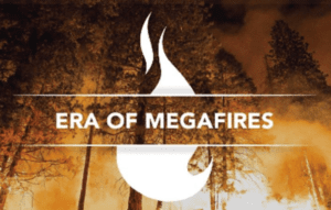
View the Ted Talk.
The Era of Megafires is a 70-minute, multi-media presentation hosted by Dr. Paul Hessburg, who has conducted fire and landscape ecology research for more than 27 years. The presented material comes in the form of fast-moving, short, topic-based talks interspersed with compelling video vignettes and features the work of wildfire photographer, John Marshall. Think Ted X mixed with snappy documentary shorts and compelling photography. The videos are produced by award-winning documentary film company, North 40 Productions, of Wenatchee, WA.
The presentation is designed to educate audiences across the West so that they may better participate in the conversation and solutions surrounding the Megafire issue.
Sponsors for this event include U.S. Forest Service Intermountain Region, Salmon-Challis National Forest and the Northern Rockies Fire Science Network.
The presentation will take place at the Sacajawea Center in Salmon, Idaho. Doors will open at 6:30PM, and the presentation will begin at 7:00PM.

Learn more from the overview webinar.
Access training modules.
This learning series responds to Section 7.b.iii, Action Item #5 within the Fuels section of the 2015 Integrated Rangeland Fire Management Strategy, which calls for a comprehensive knowledge transfer program to enhance the fuels management program’s role in sagebrush-steppe management. The Strategy is intended to improve the efficiency and efficacy of actions to address rangeland fire, to better prevent and suppress rangeland fire, and improve efforts to restore fire-impacted landscapes.
The learning modules synthesize the state of the science for six management topics:
- Background and origins of the conservation problems facing the sagebrush steppe and greater sage-grouse
- Understanding and applying the concepts of resistance and resilience
- Management of sagebrush ecosystems experiencing conifer encroachment
- Management of sagebrush ecosystems at risk of or invaded by invasive annual grasses
- Restoration of sagebrush steppe ecosystems
- Issues specific to the eastern range of greater sage-grouse
The LANDFIRE Program strives to produce consistent fire behavior fuel model grids for the U.S. These models are relevant for predicting fire behavior, including spread and intensity, during average conditions; however, they often fall short during drought or seasonably dry conditions.
To address the need for that information, LANDFIRE developed a seasonal product named the Modeling Dynamic-Fuels with an Index System (MoD-FIS). These provisional products have been released for the Southwest and Great Basin regions, and are ready for testing and review by those who use LANDFIRE data. In this webinar, Charley Martin and Tobin Smail offer a MoD-FIS primer, explain how the products can be used in these regions, and solicit users’ input and review.
This webinar was co-hosted by LANDFIRE and members of the Joint Fire Science Program: Great Basin Fire Science, Southwest Fire Science, and Northern Rockies Fire Science. Content addresses challenges that managers of large landscapes deal with in these regions.
This webinar describes:
- The long-term (17-26 year) post-fire accumulation in fuel loads and resultant potential fire behavior where historical prefire and immediate postfire data exists in Wyoming and Basin big sagebrush communities.
- Fuel loads accumulation and structure along a time-since-fire. chronosequence in Wyoming, mountain, and low sagebrush ecosystems
- The fuels and reburn potential in once and twice burned Basin big sagebrush plant communities.
- Plant community change 17 years post fire in Wyoming big sagebrush ecosystems.
Presented by: Lisa Ellsworth, Oregon State University.
- Restoring & managing “Emerald Isles”
- Strategic, multi-scale approach for managing threats to sagebrush ecosystems based on resilience and resistance concepts
The Society for Range Management’s 71st Annual Meeting, Technical Training and Trade Show was at the Nugget Hotel in Sparks, Nevada. The theme for the 2018 conference was Empowerment through Applied Science.
Access short course.
This open-access short course provides fundamental information on rangeland ecology and management. It is hosted by the University of California Rangelands Research & Education Archive and is of interest to staff in government agencies and NGOs who manage local, state, and federal lands—including open space districts, county parks, water districts—and those who conduct education programs on these lands.
The four module course was developed by Dr. Mel George and Cody Sheehy in collaboration with UC Cooperative Extension Livestock and Natural Resource Advisors and University of California and California State University faculty. Course materials were developed with support from USDA Western SARE and RREA.