Fuels & Fuel Treatments
Access LANDFIRE tools.
LANDFIRE is a shared program between the wildland fire management programs of the USDA-FS and DOI, providing landscape scale geo-spatial products to support cross-boundary planning, management, and operations. It provides over 20 national geo-spatial layers (e.g. vegetation, fuel, disturbance, etc.), databases, and ecological models that are available to the public for the US and insular areas.
View an introductory LANDFIRE video.
View fact sheet.
This fact sheet provides land managers with a brief summary of the effects of conifer expansion and infill in sagebrush ecosystems and of potential management strategies.
View report.
The initial report includes actions to be implemented by Interior’s bureaus to immediately address the threat of rangeland fire to Western sagebrush-steppe landscapes and improve fire management efforts before the start of the 2015 wildfire season.
View report.
This report outlines national and regional prescribed fire activity, state prescribed fire programs, and identifies impediments limiting the use of prescribed fire. The results include all federal, state, and private prescribed fire acres for forestry, rangeland, and agricultural burning that occurred in 2014.
View article.
This study evaluated how divergence from historic (pre-Euroamerican settlement) fire frequencies due to a century of fire suppression influences rates of high-severity fire in five forest types in California. With some variation, results suggest that fires in forest types characterized by fuel-limited fire regimes (e.g., yellow pine and mixed conifer forest) tend to burn with greater proportions of high-severity fire as either time since last fire or the mean modern fire return interval (FRI) increases.
View the Order.
This Order sets forth enhanced policies and strategies for preventing and
suppressing rangeland fire and for restoring sagebrush landscapes impacted by fire across the West. These actions are essential for conserving habitat for the greater sage-grouse as well as other
wildlife species and economic activity, such as ranching and recreation, associated with the sagebrush-steppe ecosystem in the Great Basin region.
View report.
This report provides a GIS protocol for identifying strategic locations for fuel breaks to protect remaining large patches of habitat. It was prepared by The Nature Conservancy for the Western Association of Fish and Wildlife Agencies (WAFWA).
Geodatabase that accompanies the report –
File 1 (682MB)
File 2 (84.5MB)
View abstracts.
These abstracts of recent papers on rangeland management in the West were prepared by Charlie Clements, Rangeland Scientist, USDA Agricultural Research Service, Reno, NV.
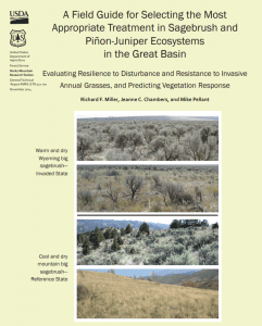
View field guide.
This field guide identifies seven primary components that largely determine resilience to disturbance, as well as resistance to invasive grasses and plant succession following treatment of areas of concern. An evaluation score sheet is included for rating resilience to disturbance and resistance to invasive annual grasses and the probability of seeding success.
View article.
This Science article reports on a growing body of research challenging the widespread notion that beetle-killed forests are more vulnerable to more severe fires than those that have escaped infestation. The findings are highlighting the complex causes of western wildfires and raising new questions about the efficacy of some fire prevention policies, such as plans to remove beetle-killed trees from vast swaths of forest.


