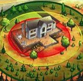
Wildland Urban Interface
Visit course website.
Learn how ESCAPE (WUI Fire Evacuation and Sheltering Considerations — Assessment, Planning, and Execution) provides crucial guidance for wildfire evacuation planning, enhancing life safety for civilians and first responders.
This course is available anytime and takes about 3 hours to complete.
Training details and registration.
In this streamlined class, you’ll learn how to guide a focused and actionable Community Wildfire Protection Plan process that delivers results. You’ll learn to:
- Map out each stage of CWPP development
- Assess local wildfire risks using trusted tools
- Engage your community and prioritize treatments
- Build and implement a results-driven action plan
Training will be JUNE 9 – 10
8 A.M. – 5 P.M. Redmond Fire and Rescue
341 NW Dogwood Ave. Redmond, Oregon
Webinar recording.
Communities have long used landscaping codes to reduce water consumption, but a few stand-out cities have crafted codes that pair water-wise goals with fire-wise principles. Join experts for an hour-long webinar exploring how these double-duty landscaping codes can reduce fire risk and encourage water conservation in your community.
Webinar details and join link.
Wildfires are becoming more destructive as burned area increases and as more homes are built in the wildland-urban interface, but it is unclear how these patterns are affected by changing wildfire behavior in different fuel types. To better understand changing patterns of wildfire destruction, we mapped buildings exposed to and destroyed by wildfires in the conterminous U.S. from 2000-2020. From these maps, we determined that the probability of an exposed building being destroyed by wildfire has more than tripled over the past two decades, and that more wildfire destruction is occurring in forests relative to grass and shrublands. Understanding these changing patterns can help us design more effective strategies to mitigate risk.
Webinar registration.
Informative webinar on fire-resistant plants and commonly found species in New Mexico. Also, learn more about effective landscaping techniques to help reduce wildfire risk and protect your property.
View article.
Previous research has examined individual factors contributing to wildfire risk, but the compounding effects of these factors remain underexplored. Here, we introduce the “Integrated Human-centric Wildfire Risk Index (IHWRI)” to quantify the compounding effects of fire-weather intensification and anthropogenic factors—including ignitions and human settlement into wildland—on wildfire risk. While climatic trends increased the frequency of high-risk fire-weather by 2.5-fold, the combination of this trend with wildland-urban interface expansion led to a 4.1-fold increase in the frequency of conditions conducive to extreme-impact wildfires from 1990 to 2022 across California. More than three-quarters of extreme-impact wildfires—defined as the top 20 largest, most destructive, or deadliest events on record—originated within 1 km from the wildland-urban interface. The deadliest and most destructive wildfires—90% of which were human-caused—primarily occurred in the fall, while the largest wildfires—56% of which were human-caused—mostly took place in the summer. By integrating human activity and climate change impacts, we provide a holistic understanding of human-centric wildfire risk, crucial for policy development.
View field guide.
The National Wildfire Coordinating Group (NWCG) Wildland Urban Interface Mitigation Field Guide, PMS 053 provides mitigation practitioners at all experience levels with recommendations on the most effective and efficient ways to accomplish mitigation work in communities at risk to wildfire damage or destruction. The content in this guide was written in coordination with the NWCG Standards for Mitigation in the Wildland Urban Interface, PMS 052.
View factsheet.
This brief summarizes a recent study that assessed factors driving perceived defensibility through the lens of wildland firefighters to learn more about how they evaluate the risks associated with different structures. It provides insight into structure defensibility in action, and the factors that firefighters may consider when they engage a fire near structures.


